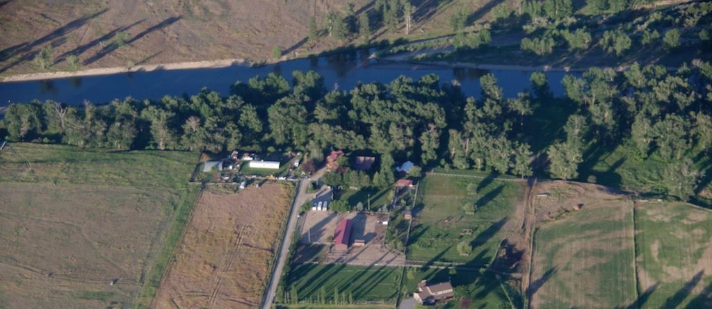
Dunrovin Ranch is located along the Bitterroot River in some of the most beautiful and interesting country in the world. Western Montana is known for its forested and snow capped mountains, its clear, cold creeks and white water rivers, its high mountain meadows, its wide, handsome valleys, and its abundant wildlife. It is also know for its outgoing people, its charming little communities, and its many wonderful cultural features that blend small town friendliness with big city sophistication and quality. It is truly the Last Best Place.
The Bitterroot Valley
The stunning Bitterroot Valley extends nearly 100 miles south from Missoula into Lost Trail Pass on the Montana – Idaho border. The entire Valley is lined with mountains on either side - to the west is the Bitterroot Range and the large Selway-Bitterroot Wilderness Area; to the east you will find the smaller Sapphire Mountains and the Anaconda-Pintler Wilderness Area. On the west side of the valley are numerous deeply-carved granite canyons, such as the scenic Blodgett Canyon and Bass Creek Canyon. Trapper Peak is the highest point in the “Bitterroots,” at more than 10,150 ft. in elevation and provides a dramatic punctuation to the southern end of this valley. Highway 93 is the major north-south highway running through the center of Bitterroot Valley, offering some of the America’s most scenic highway vistas.
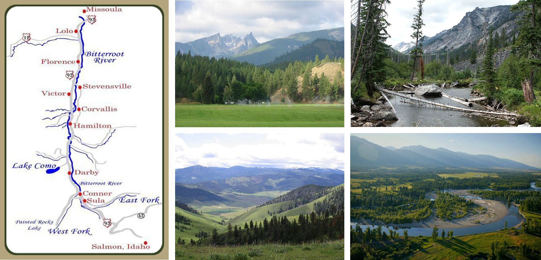
The wide mostly flat valley bottom is known for its fertility and relatively moderate climate and supports a number of ranches and farms that work hard to feed local Montanans. Along the length of the valley, the Bitterroot River ripples and curves, offering blue ribbon fishing, as well as float trips in the summer months. The terrain of the Bitterroot Valley changes considerably between the northern and southern portions. The northern end is quite flat and open. It is considerably wider than the southern portion with beautiful panoramic views overlooking hay fields and towns, all with beautiful mountain backdrops. The southern end narrows and is barely five miles wide. The Bitterroot River splits into the East and West Forks and you have more trees and close-up views of mountains, rock formations and wildlife.
The first settled community in the valley sprung to life when St. Mary’s Mission was established in 1841 and followed shortly by Fort Owen—around 1850. This early establishment quickly evolved into what is now the vibrant community of Stevensville. Soon after, other early settlements began to spring up and down the valley located about a day’s horseback ride apart. These settlements have all evolved into friendly, little communities that are unique centers for outdoor recreation, festivals, and high quality living. From north to south and starting with our own community, you will find:
- Lolo, home of Travelers’ Rest Montana State Park, the Lolo Square Dance Center, Lolo Hot Springs, and the best steak in all of Montana at Lolo Creek Steak House
- Florence, location of one of our favorite Italian Restaurants, Caffé Firenze
- Stevensville, Montana’s oldest European settlement celebrates its agricultural heritage each year with the Northwest Honey Fest
- Victor, where they annually celebrate their namesake, Chief “Plenty of Horses” Victor
- Corvallis, home of the Teller Wildlife Refuge
- Hamilton, a bustling little city that boasts one of the nation’s leading research labs, the Rocky Mountain Laboratories
- Darby, know for it logging history which they celebrate every year during Logger Days
- Conner and Sula both serve as gateways to Lost Trail Pass, one of Montana’s favorite places for both downhill and cross county skiing, and Lost Trail Hot Springs.
The Bitterroot River
The Bitterroot River is a wide artery of free flowing, clear water, winding over 80 miles from the Bitterroot Mountains to its confluence with the Clark Fork River in Missoula.
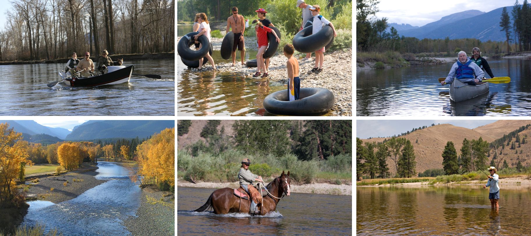
Internationally known as a blue ribbon fly fishing river, the Bitterroot’s many riffles, deep pools, fallen trees, and seasonal hatches make it one of Montana’s most popular fly-fishing destinations. Anglers enjoy a long season wrangling cutthroat, brown, rainbow, and brook trout beginning in early March and extending through November. To cast your line a little further, check out our partner Grizzle Hackle who will happily take you on a guided float or wade trip. Be sure to visit Montana Fish, Wildlife, and Parks Field Guide for information on all the fish that can be found in the Bitterroot River.
Dunrovin's favorite term for the Bitterroot River is friendly. Except during the high spring run-off, the Bitterroot’s gentle flow and crystal-clear water is perfect for long, lazy summer floats whether in canoe, drift boat, raft, or inner tube. The enticing, cool water is irresistible in the heat of the afternoon and picnicking on one of the numerous sandy beaches or gravel bars is the perfect reprieve.
The excellent habitat of the Bitterroot River and its riparian corridor provides Dunrovin’s guests with ample opportunity to view wildlife. The Bitteroot Birding and Nature Trail guides visitors through some of the valley’s most vibrant bird habitat and nature viewing areas and the Montana Natural History Center offers tours lead by local naturalists.
The Lewis and Clark Expedition
The wild terrain and striking beauty of the Bitterroot Valley has held travelers in reverence since the days of Lewis and Clark. The Corps of Discovery entered the area in the fall of 1805 through the southern part of the valley, at Lost Trail Pass. From there, they traveled north toward present day Missoula to the confluence of Lolo creek and the Bitterroot River. At this juncture, which was named Traveler’s Rest, the Corps of Discovery turned westward once more, to cross over the Bitterroot Range through Lolo Pass—following Lolo Creek and the Nez Perce Trail. In July of 1806 the Corps of Discovery visited Traveler’s Rest again on their return journey eastward. At that time, the group split into two; with Lewis headed northeast and Clark south, for further discovery.
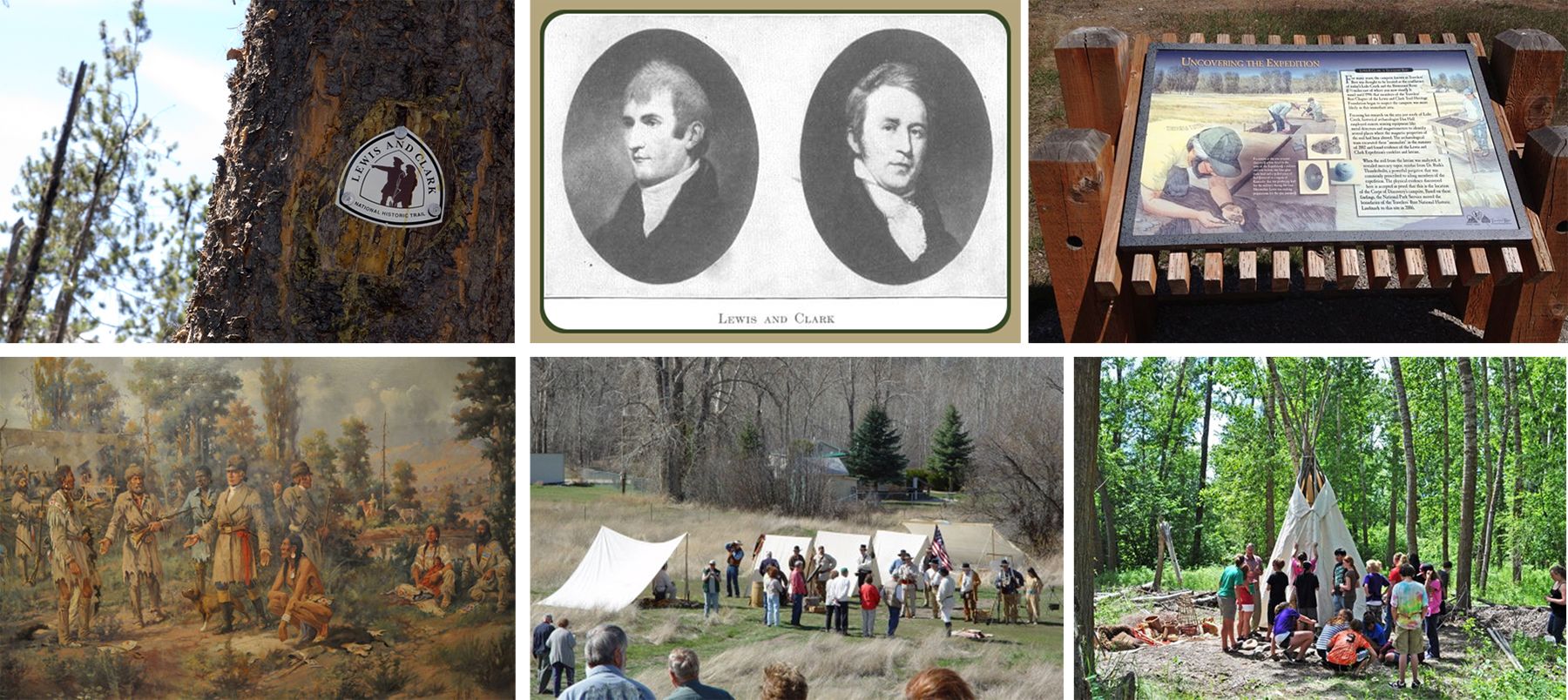
At many places in “The Bitterroot,” visitors can read roadside signs that illustrate Lewis and Clark’s movement through the valley. Yet, most don’t suspect that Dunrovin Ranch has one of these markers on its property that actually provides incorrect information identifying the location of Travelers Rest, which is now a state park. Fortunately, this was a short-lived mistake and Traveler’s Rest State Park has been correctly identified 1.3 miles west of the ranch.
The Traveler’s Rest Preservation and Heritage Association has been a driving force in helping Traveler’s Rest State Park develop a museum and visitor’s site that tell the compelling story of the Corps of Discovery. Bill and Ramona Holt of the Holt Heritage Museum have been particularly supportive and instrumental in making Traveler’s Rest the center of Lolo and bringing the story of Lewis and Clark to visitors and residents alike.
Dunrovin Ranch owners, Sterling and SuzAnne Miller, have long been ardent fans of Lewis and Clark, marveling at their courage and leadership. The more they learned, the more impressed they were. It is nearly impossible not to be awed by their achievement. They lost only one person to sickness during their two year journey. They sought and obtained friendship and assistance from most of the American Indian tribes they encountered, with only one hostile encounter that ended in an Indian fatality. Their scientific findings and measurements were rigorous and invaluable in understanding the country through which they traveled, and their sense of geography coupled with their just and confident leadership of the corps made the expedition successful. One of the Miller’s favorite places for finding information about them is Discovering Lewis and Clark.
Dunrovin Ranch strives to emulate the characteristics so aptly demonstrated by the Corps of Discovery by celebrating courage to explore new territory with a sense of scientific and cultural curiosity and respect, fostering a connection with local residents for better understanding of place, demonstrating a focus on the safety of all involved, and approaching the natural world with a sense of awe.
Dunrovin Ranch - a Bird's Eye View
Dunrovin Ranch utilizes private, leased, and permitted state land for its operation. The GoogleEarth photo below indicates the property lines, the osprey nest pole, and the fishing locations most used by ospreys nesting at Dunrovin: the Bitterroot River, the lake, and local fish ponds.
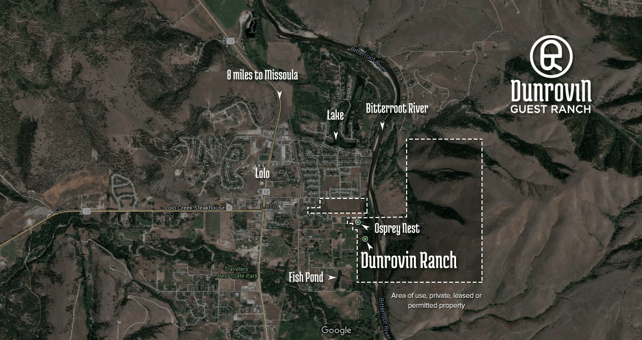
The view below shows the same area as seen from a low flying plane. If you look carefully, you will note the osprey nest and camera pole to the left of the red roof on Dunrovin's barn and the ranch camera pole to the right and towards the river from the red roof.
